Aerial Data | South Florida
Decision-grade aerial data for South Florida
Drone inspections, aerial mapping, and radiometric thermal surveys for buildings, construction, and solar assets. Captured by FAA-certified pilots, processed with photogrammetric and AI-assisted analytics, delivered as reports your engineers, adjusters, and asset managers can act on.
24-Hour
Standard report turnaround
3 Counties
Miami-Dade, Broward, Palm Beach
6 Industries
One capture standard
EN · ES
Fully bilingual reporting
What We Deliver
Two layers of the same roof
A photograph shows what a roof looks like. Radiometric data shows what is happening underneath it. Every SurveyTech deliverable is built from measurable data: scaled orthomosaics, per-pixel temperature values, and findings labeled by confidence. The professionals who rely on our reports can defend them, because we can.
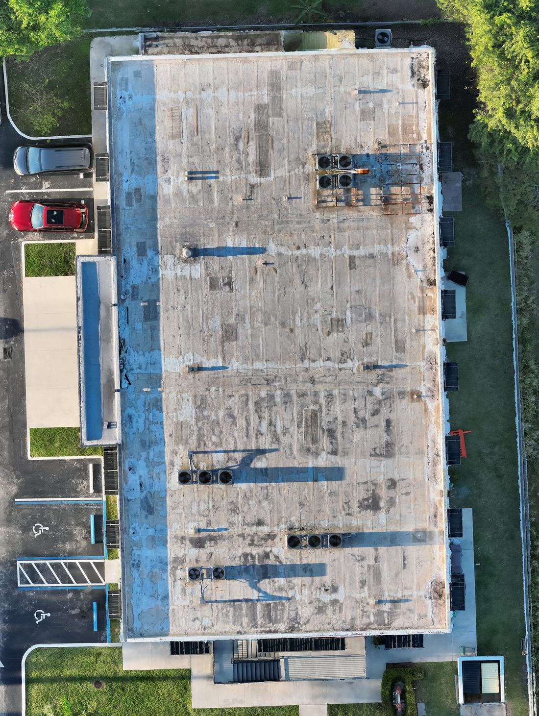
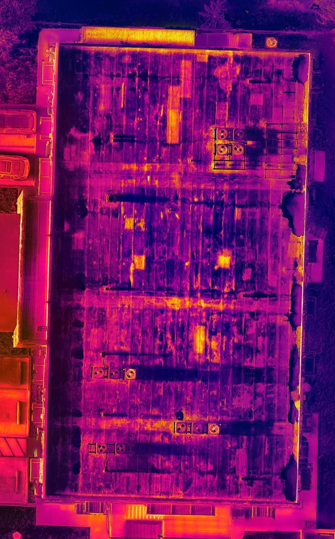
Processing combines photogrammetry with AI-assisted anomaly detection. Every finding is reviewed by the pilot in command before it reaches your report, and inconclusive results are marked exactly that.
Services
Aerial data services
Every engagement is quoted by scope: site, access, deliverables, and turnaround. No two projects are priced the same because no two sites are the same.
Aerial Mapping & Orthomosaics
Scaled 2D orthomosaics, 3D models, and site documentation for planning, progress records, and asset management. RTK-positioned capture for consistent, repeatable accuracy.
Construction Progress Monitoring
Recurring aerial documentation of active sites. Comparable flight-to-flight records for owners, lenders, and general contractors, from baseline capture through closeout.
Infrared & Thermal Surveys
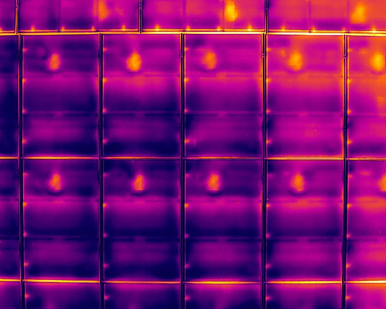
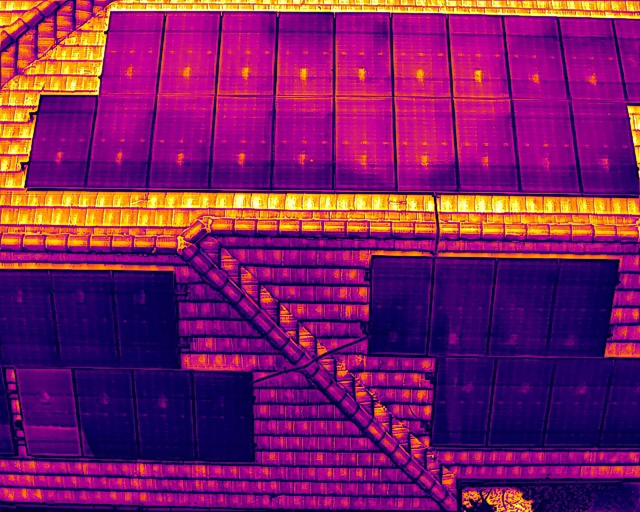
Radiometric thermal imaging of roofs, envelopes, and equipment. Moisture patterns, insulation loss, and electrical anomalies made visible and measurable.
Infrared drone survey in MiamiRoof & Facade Inspections
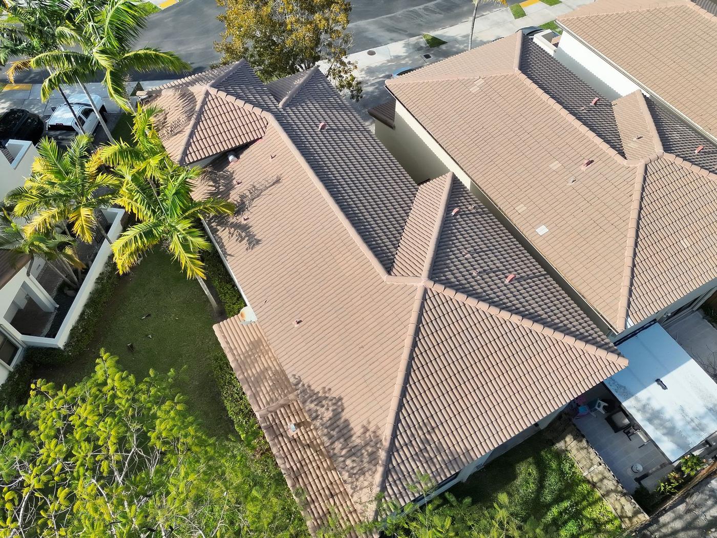
High-resolution roof and elevation imagery for condition documentation, milestone and recertification support, and insurance claims. No ladders, no scaffolding, no disruption.
Solar PV Thermal Analytics
Module-level thermography aligned to IEC 62446 methodology, with AI-assisted anomaly classification for hotspots, diode failures, and string outages.
Asset & Infrastructure Inspections
Aerial condition documentation for equipment, utilities, and distributed portfolios. Consistent capture standards across every site, every visit.
Industries
Built for the teams that carry the risk
Six industries, one discipline: defensible data, captured to specification, delivered on time.
Insurance & Claims
Documentation adjusters can defend. Pre-loss baselines, post-loss condition capture, and thermal evidence of moisture intrusion.
Construction & Development
Progress records lenders trust. Recurring documentation from groundbreak to closeout, comparable flight to flight.
Engineering & Recertification
Data captured to the engineer's specification. Elevation sets and indexed imagery that support milestone and recertification work.
Roofing
Scope with data, not guesses. Thermal moisture mapping that separates repair from replacement before the crew rolls.
Real Estate & Property Management
Portfolio condition intelligence. Consistent aerial records across every building you manage, on a schedule you set.
Solar
Production protected. Module-level thermal analytics that locate faults monitoring alone can miss.
Field Work
Recent capture
Process
How an engagement runs
Scope & authorization
We confirm the site, access, deliverables, and airspace. Most of Miami-Dade and Broward sits under controlled airspace, so FAA authorization is arranged before flight day, not on it.
Capture
RTK-positioned mapping flights for scale and repeatability. Post-sunset radiometric passes when thermal contrast demands it. Conditions logged with every frame.
Processing & analysis
Photogrammetric reconstruction and AI-assisted analytics, reviewed by the pilot in command. Findings are labeled by confidence and inconclusive results are marked as such.
Delivery
Annotated PDF report plus an indexed imagery catalog. Visual work within 24 hours, radiometric analysis within 48 to 72. In English or Spanish.
About SurveyTech
The camera, not the opinion
SurveyTech Florida LLC is a founder-led aerial data company based in Doral, serving Miami-Dade, Broward, and Palm Beach counties in English and Spanish.
Our role in your project is deliberately narrow and deliberately honest: we capture and process the data. Findings are labeled by confidence. Inconclusive results are marked inconclusive. Engineering conclusions stay with the licensed professionals who own them.
That discipline is the reason engineers, adjusters, and asset managers can put our reports in front of the people they answer to.
FAQ
Common questions
What areas does SurveyTech Florida serve? +
We are based in Doral and serve the South Florida tri-county area: Miami-Dade, Broward, and Palm Beach counties. That includes Miami, Hialeah, Coral Gables, Fort Lauderdale, Hollywood, Pembroke Pines, West Palm Beach, Boca Raton, and the communities around them.
Are you FAA certified and insured? +
Yes. Every flight is conducted under an FAA Part 107 Remote Pilot Certificate, and the company carries commercial liability insurance. A certificate of insurance is available on request for any project.
How fast are reports delivered? +
Visual deliverables are standard within 24 hours of the flight. Radiometric thermal analysis takes 48 to 72 hours because the raw thermal data requires processing against recorded capture conditions. Post-storm and emergency turnaround is available.
Is a drone survey the same as a land survey? +
No. Our work is condition assessment and aerial data capture. It does not establish property boundaries, elevations, or legal descriptions, and it is not a substitute for work performed by a Florida licensed Professional Surveyor and Mapper. Where a project requires a signed and sealed survey product, we capture data in support of the licensed professional rather than in place of one.
Do you work in English and Spanish? +
Yes. SurveyTech Florida is fully bilingual. Scoping calls, field coordination, and final reports are available in English or Spanish, whichever your team works in.
Can you fly in controlled airspace near Miami airports? +
Yes. Most of Miami-Dade and Broward sits under controlled airspace, and flights there require FAA authorization through the LAANC system. We arrange authorization during scoping, before flight day, so airspace never becomes a schedule surprise.
Contact
Request a quote
Tell us the property type, the city, and what decision the data needs to support. We reply with a scoped quote and the next available flight window.