SurveyTech Florida Blog
Milestone Inspections Are Coming Due Across South Florida. Here Is Where Aerial Data Fits.
August 8, 2026 · 3 min read · First published on the SurveyTech Florida LinkedIn page
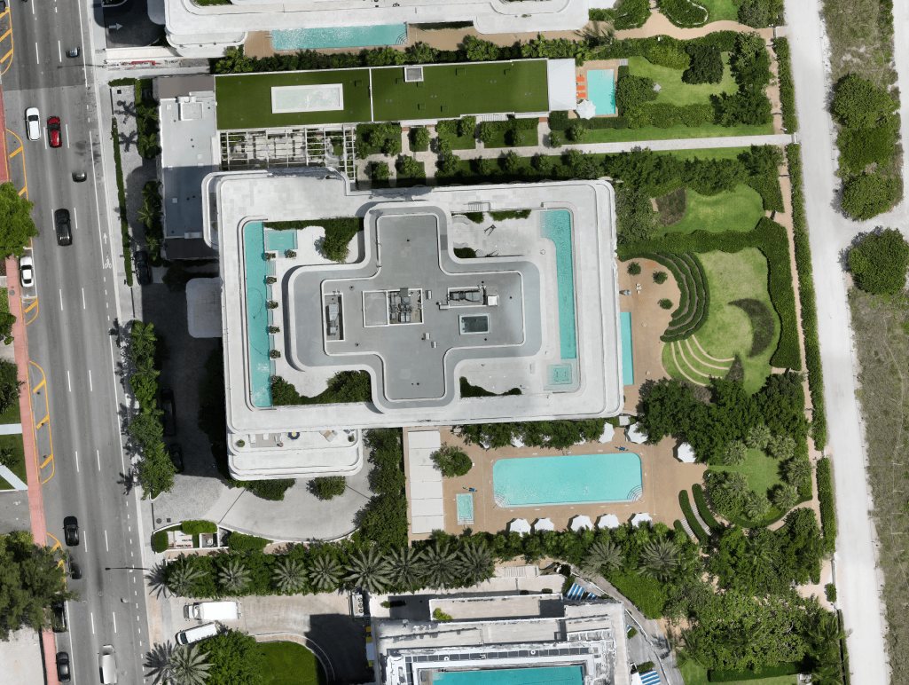
Florida's milestone inspection framework has put thousands of condominium buildings across Miami-Dade, Broward, and Palm Beach on a compliance clock. Buildings are coming due, boards are budgeting for evaluations, and the engineers performing them need condition data they can stand behind.
Roof and facade condition is a central component of these evaluations, and it is exactly the data that is hardest to collect from the ground.
What aerial capture changes
Drone capture gives engineers and building officials a complete visual and thermal record of the roof and every elevation, without scaffolding, without roof access, and without disrupting residents. A full envelope capture that would take days of access coordination happens in a single scheduled visit.
- →High-resolution aerial imagery of the full roof and every facade
- →Thermal scanning for suspected moisture intrusion and membrane anomalies
- →GPS-tagged, indexed documentation organized for engineering review
- →Bilingual reporting in English and Spanish for boards and managers
The line we do not cross
A drone company does not perform a milestone inspection. The engineer of record does. Our role is deliberately narrow: we capture the data to the engineer's specification, label findings by confidence, and mark inconclusive results as exactly that. Structural determinations stay with the licensed professional who owns them.
That discipline is why the record works. An engineer can put our imagery in front of a building official. A board can put it in front of owners. Nobody has to defend a conclusion the data does not support.
Who we work with
Structural and building envelope engineers scoping milestone and recertification work. Condo associations and property managers preparing buildings for evaluation. Compliance teams that need a documented baseline before the clock runs out.
Put aerial data on your next project
Tell us the property type, the city, and what decision the data needs to support. We reply with a scoped quote, usually the same business day.